You are here
Satellite Technology
This technology has exploded on to the agriculture industry and is having an immediate impact on the quality of information we can gather and literally changing the way we run our farms. Equipment can be guided through steering systems far more accurately than the best operators and significantly reduce the stress and fatigue during long hours. Maps can be created combing yield data and geographical positioning which can be overlaid onto Infrared images setting up for precission application of nutrients. Measures can be taken to even out the variations in the soil through application of amendments like gypsum, compost, lime, wood ash or specific nutrient components. Some farms are using technology which can apply variable rates of crop inputs to area specific needs automatically with great accuracy.
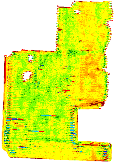
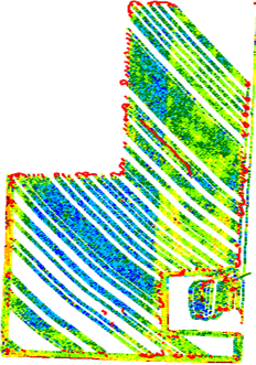
These two images are yield data collected on the same field in two different years. The gaps in the image are from areas that were harvested with a second machine that did not have the capability to collect data. The blue area is significantly higher yields on the exact ground which grew a potato crop the previous year. The green area in the second image shows the same area again with higher yields two years following potatoes.


